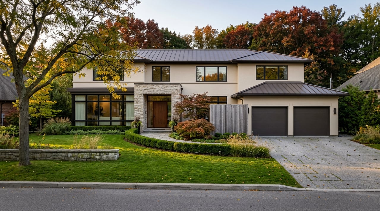
The City of Toronto describes St. Andrew-Windfields as a neighbourhood "which has provided homes for a famous artist, several successful dairy families, and even a fictitious television family." That sentence sits inside an official municipal walking tour, on a city-run itinerary most people who live here have never opened, let alone walked start to finish.
It is not a metaphor for the neighbourhood's character. It is a literal list of addresses, built by the City of Toronto's StrollTO program, that connects a 19th-century dairy farm, a church older than the suburb around it, an illustrator's home on Yonge Street, and a 2012 mansion that spent its first television appearance pretending to be someone else's house. You have probably driven past four or five of these stops without knowing they were part of the same route.
A Route the City Already Wrote
StrollTO launched as part of ShowLoveTO, the city's initiative to help Toronto recover from the disruptions of COVID-19 by pointing residents toward their own neighbourhoods instead of downtown. What started as a pandemic-era project has stuck around. This year, the city's self-guided tours page lists 159 free itineraries covering nearly every part of Toronto, and St. Andrew-Windfields has its own entry, stop by stop, address by address.
The route runs roughly along the Leslie Street corridor near York Mills Road, threading through a stretch of the neighbourhood most people associate with quiet, tree-lined streets and not much else. That is the point of the exercise. The tour does not send you to a landmark. It sends you past houses and parks you already pass, then tells you what you are actually looking at.
Where the Suburb Was Still a Dairy Farm
Before St. Andrew-Windfields was a name on a real estate map, it was farmland worked by families like the Duncans. David Duncan was a dairy farmer credited with introducing Jersey cows, prized for high-butterfat milk, to Ontario. He named his land at York Mills and Don Mills "Moatfield," a name that still labels the local parkland today, and around 1865 he built a farmhouse on the property.
That farmhouse still exists. Known today as the Duncan Gingerbread Farmhouse at 125 Moatfield Drive, it is one of the last remaining examples of Gothic gingerbread style architecture in Ontario. It was not built where it stands now. The building was physically relocated to its current site in 1986 and has since been designated a heritage building, which means someone judged it worth saving and moving rather than demolishing when development pressure came for the original lot.
A short walk away, Moatfield Farm Park at 355 Lesmill Road holds two more pieces of the same story: the William Goodwin House, a wood-framed home built around 1845 that was moved to the park from its original Yonge Street location in 1982, and the Clark Locke House, a Tudor-style building from 1933. Both are now used as office space by Ontario Nature. You cannot go inside, but you can see, from the outside, how a working farm turned into parkland and then into offices for an environmental charity, all on the same footprint.
Nearby, at 360 Lesmill Road, sits Eva's Place, which opened in 1994 as North York's first youth shelter offering support to prevent youth homelessness. It is named for Eva Maud Smith, who emigrated from Jamaica in 1956 to work as a domestic worker. It has nothing to do with dairy farming or heritage architecture, but it sits on the same short stretch of road, a reminder that the neighbourhood's land has kept being repurposed for community use long after the last cow left the field.
| Stop | Address | What You're Actually Looking At |
|---|---|---|
| Duncan Gingerbread Farmhouse | 125 Moatfield Drive | Ontario's last Gothic gingerbread farmhouses, relocated here in 1986 |
| Moatfield Farm Park | 355 Lesmill Road | Two 19th and 20th-century heritage houses, now Ontario Nature offices |
| St. John's Anglican Church | 19 Don Ridge Drive | Built 1843-1844, among the oldest standing buildings in North York |
| C.W. Jefferys Home & Plaque | 4111 Yonge Street | Home of the illustrator from 1922 to 1951, built circa 1833 |
| La Belle Maison | 30 Fifeshire Road | 24,000-square-foot 2012 build, used for Schitt's Creek interiors |
The Church That's Older Than the Word "Suburb"
St. John's Anglican Church, at 19 Don Ridge Drive, was built in 1843 and 1844 to a design by John George Howard, replacing an earlier building on the same site. That makes it one of the oldest standing structures in North York, older than the streetcar suburbs, older than the highway, older than the very idea of North York as a place distinct from the farmland around it.
Its rectory, at 174 Old Yonge Street, came later. By the 1870s the congregation wanted a proper residence for its clergy, and the plans, drawn by a carpenter and lumber merchant named Mr. Fisher of Eglinton, were approved in 1876. Construction went ahead under contractor Joseph Pennock, and the first clergyman to live there was Canon Henry Bath Osler. Unlike the farmhouse down the road, the rectory has never been moved. It is one of the few 19th-century buildings in the community that has stayed exactly where it was built.
The cemetery beside the church holds the graves of several early North York residents, including two names that would surprise most passersby: Lionel Conacher, the hockey player often remembered as one of Canada's greatest all-around athletes, and C.W. Jefferys, the illustrator whose own former home is the next stop on the walk.
The Artist's House on Yonge Street
At 4111 Yonge Street stands a house built around 1833 by Rowland Burr, the man who supervised the straightening of Yonge Street itself in the 1830s. It later served as the parsonage of York Mills Presbyterian Church before becoming, from 1922 to 1951, the home of Canadian artist C.W. Jefferys, who worked as an illustrator and taught drawing and painting at the University of Toronto.
The house is private property today, and the StrollTO guide is explicit that it should be viewed from the sidewalk only. A plaque marks the spot. It is easy to walk or drive past without registering that the man who spent nearly thirty years there helped shape how generations of Canadians pictured their own history through his illustrations, and that he is buried a few minutes away in the same churchyard he would have passed on his own walks.
The Detour Nobody Expects
Then the route jumps forward almost two centuries. At 30 Fifeshire Road sits La Belle Maison, a 24,000-square-foot house built in 2012 with a foyer inspired by the Sistine Chapel. Its exterior never appeared on screen, but its interior was used to film the Rose family's original mansion at the start of Schitt's Creek, the Canadian comedy that went on to sweep the Emmys. The show's opening premise depends on that family losing everything they had inside a house exactly like this one.
This is also private property, and the tour asks the same thing it asks at the Jefferys home: stay on the sidewalk. But the contrast is hard to miss. A house built to represent the beginning of a fictional family's downfall sits blocks from a farmhouse that was moved twice to survive, a rectory built by a carpenter's careful plans in 1876, and a churchyard where a real illustrator and a real athlete are actually buried. The walking tour does not comment on that contrast. It just lines the stops up in order and lets you notice it yourself.
Walking It This Fall
The full route covers a manageable stretch near Leslie Street and York Mills Road, close enough to the York Mills subway station that transit access is not a problem. September and October give you the best version of this walk: daylight lasts into the evening, the tree cover along Leslie Street is starting to turn, and the mosquito season that makes Windfields Park miserable in July is over.
A workable order for the walk:
- Start at the C.W. Jefferys Home & Plaque, 4111 Yonge Street, and read the plaque before moving on.
- Walk to St. John's Anglican Church and its cemetery on Don Ridge Drive to see where Jefferys and Lionel Conacher are buried.
- Continue to St. John's Rectory on Old Yonge Street.
- Head toward Leslie Street and Kirkwood Park, then Owen Park, both quick stops with playgrounds and green space.
- Detour to La Belle Maison on Fifeshire Road for the Schitt's Creek connection.
- Finish at Moatfield Farm Park and the Duncan Gingerbread Farmhouse on Moatfield Drive and Lesmill Road.
The city's own accessibility notes are worth following here too. Several stops are viewable only from a sidewalk or a public green space, and the tour is built with that limitation in mind rather than around it.
The Throughline
What the walk actually proves is that St. Andrew-Windfields did not become an affluent, quiet, tree-lined neighbourhood by accident or all at once. It moved through stages you can still see: farmland worked by families like the Duncans, a parish anchored by a church built before the surrounding streets existed, a period when the area was quiet enough that a working illustrator could live and teach from a house on Yonge Street for thirty years, and eventually a stage of the city that photographs well enough to double as a television set. Each stage left a building behind instead of erasing the one before it.
Most people who live here experience these buildings one at a time, as scenery. The StrollTO route is the only thing that connects them into a single line you can actually walk in an afternoon.
If you have questions about this stretch of the neighbourhood, its history, or what's changed on the streets around it, Bryan Lim is always happy to talk. Let's connect.